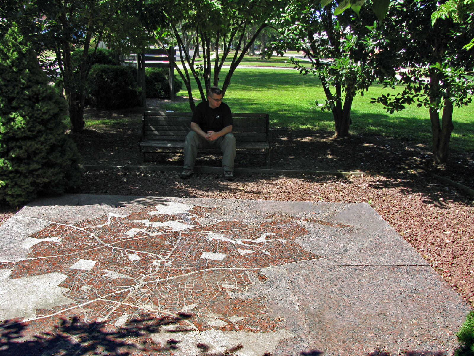
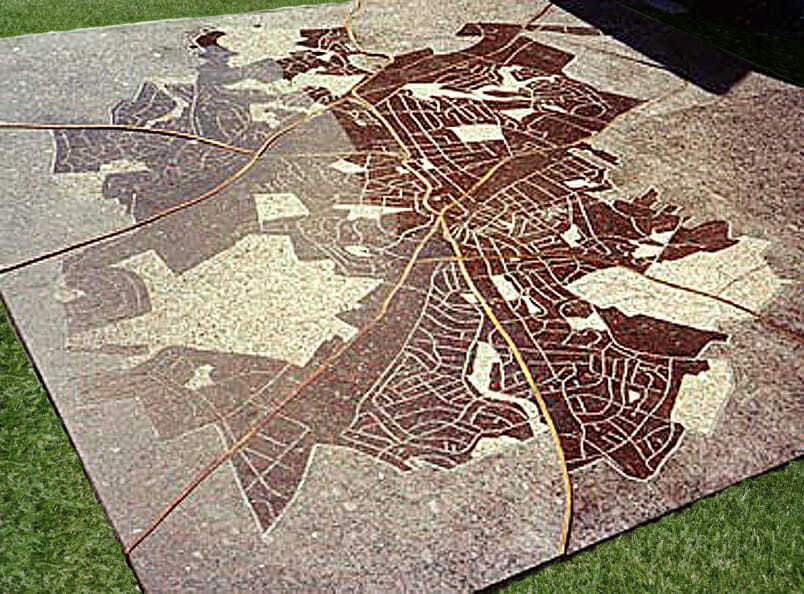
MAP OF ROCKVILLE
Rockville, MD.
144” x 144” x 2”
Granite, Brass
1992
Created out of granite and brass, this map of the City of Rockville is installed at ground level, allowing pedestrians to stand on it and orient themselves within the surrounding area. The polished granite surface is sandblasted with the city’s streets and parks, while inlaid brass strips represent major highways. Three distinct surface treatments—flamed, sandblasted, and honed—add texture and visual variation.